
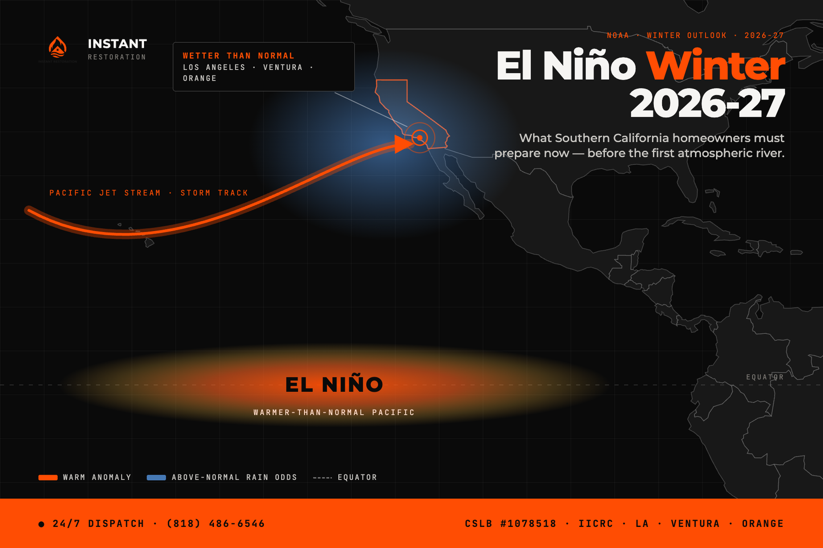
NOAA has confirmed it: a very strong El Niño is forming in the Pacific — with a greater-than-90% chance it reaches very strong intensity this fall and winter, and a 69% chance the October–December peak is historic, stronger than any El Niño since 1950. For homeowners across Los Angeles, Ventura, and Orange County, that’s not just a weather headline. El Niño 2026 Southern California flooding risk is shaping up to be the defining threat of this winter, and the window to prepare is closing before the first atmospheric river arrives.
We’ve pulled water out of homes that could have stayed dry with fifteen minutes of prep the week before a storm. This guide covers what the forecast actually means for your property and the specific steps that separate a wet driveway from a flooded living room.
What NOAA Is Forecasting for El Niño 2026 Southern California Flooding
The Climate Prediction Center’s latest ENSO diagnostic discussion puts sea surface temperature anomalies across the central and eastern equatorial Pacific at +1.4°C in the Niño-3.4 region — the signature of a strengthening El Niño.
Strong El Niño winters are historically the wettest pattern California sees. Research on past events shows atmospheric rivers — the narrow bands of moisture that deliver most of Southern California’s annual rainfall in a handful of storms — are more than twice as likely to form during El Niño conditions. That means fewer, bigger storms instead of steady drizzle, and bigger storms are what overwhelm gutters, storm drains, and hillside drainage all at once.
There’s an honest caveat worth including: strong El Niño doesn’t guarantee a wet winter. The 2015-16 event was one of the strongest on record and Southern California still saw a below-average rain year. The forecast shifts the odds, it doesn’t lock in the outcome. But “the odds are shifted toward wetter and more extreme” is exactly the kind of forecast that should move a homeowner from hoping to preparing.
Why This El Niño Is Riskier Than a Normal Wet Winter
Three things stack the deck against Southern California homes this season:
Burn scars from 2025. The Eaton and Palisades fires stripped vegetation and altered soil chemistry across large areas of Altadena, Pasadena, and the Pacific Palisades. Burned hillsides shed water instead of absorbing it, which turns a normal storm into a debris-flow trigger. USGS emergency assessments specifically flag rainfall intensity as one of the core inputs that determines debris-flow likelihood on a burned slope — and a stronger El Niño means more high-intensity rainfall events feeding those same hillsides.
Aging drainage infrastructure. Much of the storm drain and residential grading in older LA neighborhoods was designed for a drier, more predictable rainfall pattern. Atmospheric river storms dump rain faster than that infrastructure was built to move it.
Sea level. El Niño is associated with a temporary sea level rise of roughly six to ten inches along the California coast. Combine that with an already-elevated baseline from long-term sea level rise, and coastal and low-lying properties in Ventura and Orange County face a higher flood stage even before storm surge is factored in.
Your El Niño Prep Checklist Before the Rain Starts
Every item here takes an afternoon, not a contractor. Do them now, not during a flood watch.
Clear your gutters and downspouts. A clogged gutter sends water straight down your exterior walls and into your foundation. Route every downspout at least four feet away from the house.
Check your grading. Stand outside during a light rain and watch where water actually goes. If it pools against the foundation instead of running away from it, that’s a problem to fix before the first big storm, not after.
Test your sump pump, if you have one. Pour a bucket of water into the pit and confirm it kicks on and drains. A sump pump that fails during a storm is a sump pump you didn’t know was broken.
Stock sandbags or flood barriers if you’re below a burn scar or in a known flood zone. LA County Public Works publishes debris and mudflow forecasts for burn areas — check yours before assuming you’re not at risk.
Know your shutoff valves. Water heater, main line, and any exterior spigots. If a pipe fails during a storm, the difference between a puddle and a flooded first floor is how fast you can shut off the source.
Photograph your home now. Interior and exterior, room by room. If you ever file an insurance claim, “before” photos from a dry day are worth more than any receipt.
What to Do the Moment Water Gets In
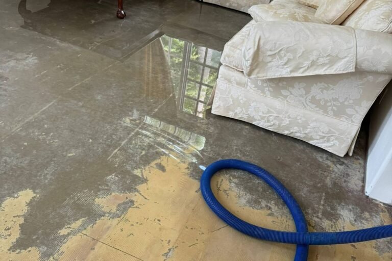
If a storm outpaces your prep and water enters your home, speed decides the outcome. Standing water starts supporting mold growth within 24 to 72 hours, and every hour after that adds cost and health risk. Extract standing water, run air movement to start drying, and document everything with photos before you touch anything for insurance purposes. If the water came from outside — storm runoff, a flooded street, a failed drain — treat it as contaminated until proven otherwise; that changes how it needs to be handled.
This is exactly the situation our water damage restoration team responds to across LA, Ventura, and Orange County — we’re a phone call away, day or night, for storm and flood emergencies. If you haven’t already, read our guide on what to do in the first 24 hours after water damage so you know the exact sequence before you need it.
We serve homeowners and property managers throughout our full Southern California service area, from the Valley to the coast.
FAQ: El Niño Winter 2026-27 in Southern California
Is El Niño confirmed for winter 2026-27?
Yes. NOAA’s Climate Prediction Center (August 2026) puts the chance of a very strong El Niño this fall and winter above 90% — with a 69% chance the October–December peak ranks as historic, stronger than any event since 1950.
Does a strong El Niño guarantee a wet winter in LA?
No. It significantly shifts the odds toward wetter, more extreme conditions, but strong El Niño winters have occasionally still come in below average. Prepare for the higher-odds outcome regardless.
Does homeowners insurance cover El Niño flood damage?
Standard homeowners policies typically exclude flood damage from rising water or storm surge; that coverage usually requires a separate flood policy. Water damage from a sudden interior source, like a burst pipe, is often treated differently. Check your specific policy language, and ask your agent directly about flood versus water damage coverage before the season starts.
What’s the biggest El Niño risk if I live below a recent burn scar?
Debris flow. Burned hillsides lose their ability to absorb water, and intense rainfall on that terrain can trigger fast-moving mud and debris. If you’re in or near the Eaton or Palisades fire footprint, follow LA County’s debris and mudflow forecasts closely this season.
Don’t Wait for the First Storm to Find Out What’s Weak
A very strong El Niño doesn’t ask permission. If your home takes on water this winter, Instant Restoration is available around the clock across Los Angeles, Ventura, and Orange County for water extraction, structural drying, and full restoration. Call us at (818) 486-6546.
Oren Gedalia, Owner — CSLB #1078518